


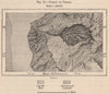


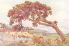


Antique maps and prints of Gran Canaria, historically called Grand Canary, including Mallet’s seventeenth-century view of Las Palmas and later island maps by Stanford, Alberto Martín and Samler Brown. Town and harbour plans cover Las Palmas and Puerto de la Luz, alongside maps of Tejeda and the island’s north-eastern slopes. Coastal charts, a volcanic illustration of Bandama and colour views published in 1911 complete the collection.
EU orders up to €150 are sent VAT- and duty-paid — no additional taxes on arrival
Authenticity Guaranteed - We only sell original antique & vintage items
Can we help? Call us on +44-208-960-3476 • FAQs
All our products are exempt from US tariffs — no additional duties or taxes payable on arrival.


- Shop by Country
- Shop by Cartographer
- Shop Maps by Type
- Shop Prints by Subject