


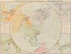


The railway is the organising thread in the maps from Guide to Manchuria & Chosen, the first volume of An Official Guide to Eastern Asia, prepared by the Imperial Japanese Government Railways and published in 1913. Regional maps link the Korean peninsula with Manchuria, town plans show Harbin, Pyongyang and Sinuiju under historical names and transliterations, and maps of the environs of Gyeongju lead to temples and historic sites. A wider route map connects East Asia with Europe by sea and the Trans-Siberian railway. Written for English-speaking travellers in the years of Japanese imperial expansion, the guide’s choice of routes and place names is revealing in itself.
EU orders up to €150 are sent VAT- and duty-paid — no additional taxes on arrival
Authenticity Guaranteed - We only sell original antique & vintage items
Can we help? Call us on +44-208-960-3476 • FAQs
All our products are exempt from US tariffs — no additional duties or taxes payable on arrival.


- Shop by Country
- Shop by Cartographer
- Shop Maps by Type
- Shop Prints by Subject