
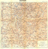


Maps from Guides Joanne - Dauphiné guided travellers through the French Alps in 1899, from a general regional sheet and route map to detailed coverage of the Queyras, Pelvoux, Grandes Rousses and Grande Chartreuse. Grenoble has a town plan and a map of its surroundings, Gap, Valence and Vienne represent the other towns, and Uriage and Allevard receive local sheets. A panorama from the Tête de la Maye offers another way of reading the mountains.
EU orders up to €150 are sent VAT- and duty-paid — no additional taxes on arrival
Authenticity Guaranteed - We only sell original antique & vintage items
Can we help? Call us on +44-208-960-3476 • FAQs
All our products are exempt from US tariffs — no additional duties or taxes payable on arrival.


- Shop by Country
- Shop by Cartographer
- Shop Maps by Type
- Shop Prints by Subject