


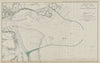


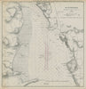


Proposed breakwaters and carefully surveyed bays fill these maps and plans, the evidence behind a Victorian inquiry into sheltering ships on dangerous coasts. They come from the 1859 report of the Harbours of Refuge Commission, which completed an inquiry recommended by a House of Commons committee the year before, printed for Her Majesty's Stationery Office by Eyre and Spottiswoode. Tynemouth, St Ives, Padstow, Wick and harbours on the Isle of Man are among the places considered, while engineering sections compare breakwaters at Alderney, Plymouth, Dover and Portland and another plate examines a wave screen. Many of the structures shown are proposals, not works already built.
EU orders up to €150 are sent VAT- and duty-paid — no additional taxes on arrival
Authenticity Guaranteed - We only sell original antique & vintage items
Can we help? Call us on +44-208-960-3476 • FAQs
All our products are exempt from US tariffs — no additional duties or taxes payable on arrival.


- Shop by Country
- Shop by Cartographer
- Shop Maps by Type
- Shop Prints by Subject