


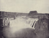


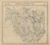


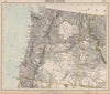

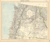


Idaho's maps run from territorial outlines of the nineteenth-century American West to specialised twentieth-century surveys. Johnson, Colton, Rand McNally and other atlas publishers set the state beside Montana, Wyoming, Oregon and Washington, with changing territorial labels and railways, while Royce's map of Indigenous land cessions charts the lands of the Shoshone, Bannock, Nez Perce and other peoples. Mud Lake survey sheets examine geology, groundwater and water supply, highway maps follow the later roads, and Cold War launch-site mapping reaches across the state line from Spokane. Pictorial maps by Ruth Taylor White and Jacques Liozu bring a lighter touch, and the prints include Bear Lake, Shoshone Falls and a humorous Heath Robinson scene.
EU orders up to €150 are sent VAT- and duty-paid — no additional taxes on arrival
Authenticity Guaranteed - We only sell original antique & vintage items
Can we help? Call us on +44-208-960-3476 • FAQs
All our products are exempt from US tariffs — no additional duties or taxes payable on arrival.


- Shop by Country
- Shop by Cartographer
- Shop Maps by Type
- Shop Prints by Subject