


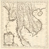


Siam, Annam, Tonkin and Cochinchina recur across these maps of Indochina, a name whose meaning shifted with European geography and colonial power. The maps cover both French Indochina and the wider mainland peninsula, reaching Burma, Thailand and the Malay approaches. Early sheets by Münster, Mallet and Bellin, with trade routes towards China and the imagined Lake Chiamay, come before atlas maps by Weller, Johnston, Bartholomew and Stanford that mark British and French spheres of influence. French political, economic and physical sheets examine Vietnam, Cambodia and Laos, insets show Saigon, Hanoi and Da Nang, and Second World War maps record the campaigns and Japanese dispositions. The prints add scenes of marriage and religious observance.
EU orders up to €150 are sent VAT- and duty-paid — no additional taxes on arrival
Authenticity Guaranteed - We only sell original antique & vintage items
Can we help? Call us on +44-208-960-3476 • FAQs
All our products are exempt from US tariffs — no additional duties or taxes payable on arrival.


- Shop by Country
- Shop by Cartographer
- Shop Maps by Type
- Shop Prints by Subject