
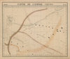


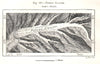





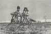

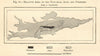

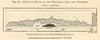




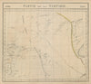


Kyrgyzstan is a land of high ranges, glaciers and mountain lakes, and its maps follow the Tian Shan and the Alai from broad atlas sheets to detailed sketch maps. Vandermaelen's atlas of 1827 still divides the territory between the Chinese Empire and Tartary, while sketch maps of 1885 show the Petrov Glacier, the Alai plateau, the Aktogoi defile near Lake Issyk-Kul and the western chains of the Tian Shan, with diagrams comparing its area and relief with the Alps and the Pyrenees. The Royal Geographical Society published the routes of Rickmers's Alai-Pamir expeditions in 1929, and a 1935 map covers the politics and economy of Chinese Turkestan. Prints of the 1880s and 1890s show Kirghiz horsemen, a river crossing, a wealthy family, interiors and a feast after a funeral.
EU orders up to €150 are sent VAT- and duty-paid — no additional taxes on arrival
Authenticity Guaranteed - We only sell original antique & vintage items
Can we help? Call us on +44-208-960-3476 • FAQs
All our products are exempt from US tariffs — no additional duties or taxes payable on arrival.


- Shop by Country
- Shop by Cartographer
- Shop Maps by Type
- Shop Prints by Subject