
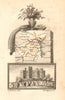

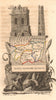

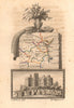

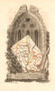

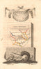

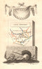

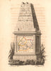


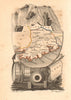


Ireland in miniature, county by county as a French reader saw it in 1824, fills most of the maps from L'Angleterre. G.-B. Depping's historical and topographical work was published in Paris by Étienne Ledoux, with maps drawn by Aristide Michel Perrot and engraved by Madame Migneret. Neighbouring counties are paired, as with Cavan and Monaghan, Meath and Louth, or Clare and Limerick, and King's County and Queen's County keep the old names for Offaly and Laois. Cork, Kerry, Mayo and Galway also appear, with a Durham and Northumberland sheet as an English example. The engraved date on checked maps precedes the book's publication.
EU orders up to €150 are sent VAT- and duty-paid — no additional taxes on arrival
Authenticity Guaranteed - We only sell original antique & vintage items
Can we help? Call us on +44-208-960-3476 • FAQs
All our products are exempt from US tariffs — no additional duties or taxes payable on arrival.


- Shop by Country
- Shop by Cartographer
- Shop Maps by Type
- Shop Prints by Subject