
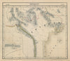


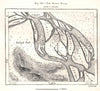


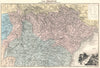


Shifting names, colonial frontiers and changing flags tell the story of Laos in these maps and prints. Zatta's eighteenth-century map of Indochina and Vandermaelen's nineteenth-century coverage precede French atlas sheets naming Annam, Tonkin and Indochina, other maps set the country beside Siam, Cambodia, Burma and southern China, and a sketch map records the Khone Phapheng falls on the southern Mekong. The prints show village life, a peasant dwelling and a festival at Luang Prabang, while plates of 1958, 1964 and 1985 record the royal standard and the national flags of different political periods.
EU orders up to €150 are sent VAT- and duty-paid — no additional taxes on arrival
Authenticity Guaranteed - We only sell original antique & vintage items
Can we help? Call us on +44-208-960-3476 • FAQs
All our products are exempt from US tariffs — no additional duties or taxes payable on arrival.


- Shop by Country
- Shop by Cartographer
- Shop Maps by Type
- Shop Prints by Subject