
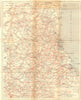


Loire cities and south-western railway routes run through these maps from Les Guides Bleus Bords de La Loire et Sud-Ouest, published by Hachette in 1922 under Marcel Monmarché's direction, just after the First World War. Detailed plans of Blois, Orléans and Poitiers sit beside wider sheets linking Tours, Bourges, Châteauroux, Niort and Angoulême, and a regional railway map shows how the guide joined its towns and excursion areas into one journey. Blois is mapped at two scales, one for finding a monument and one for the roads into the town.
EU orders up to €150 are sent VAT- and duty-paid — no additional taxes on arrival
Authenticity Guaranteed - We only sell original antique & vintage items
Can we help? Call us on +44-208-960-3476 • FAQs
All our products are exempt from US tariffs — no additional duties or taxes payable on arrival.


- Shop by Country
- Shop by Cartographer
- Shop Maps by Type
- Shop Prints by Subject