
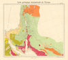


The eastern Mediterranean appears under ancient, biblical, Ottoman and modern names in these maps of the Levant, a region rather than a state, spanning Lebanon, Syria, Palestine and Jordan. Early maps by Münster and Mallet describe the Holy Land and Syria within a broad frame, while Arrowsmith and the Society for the Diffusion of Useful Knowledge separate ancient geography from the contemporary landscape. The Jordan valley, the Dead Sea and Sinai recur, sometimes as detailed insets on wider Syrian sheets. Letts adds coastal lighthouses, geological mapping shows the region's physical structure, and twentieth-century sheets record the French mandate in Syria and Lebanon and the neighbouring post-Ottoman territories, while the prints add a social subject.
EU orders up to €150 are sent VAT- and duty-paid — no additional taxes on arrival
Authenticity Guaranteed - We only sell original antique & vintage items
Can we help? Call us on +44-208-960-3476 • FAQs
All our products are exempt from US tariffs — no additional duties or taxes payable on arrival.


- Shop by Country
- Shop by Cartographer
- Shop Maps by Type
- Shop Prints by Subject