


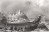


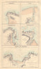

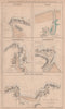


Maps and prints of Macduff include Dawson’s 1832 joint borough plan with Banff, John Thomson atlas sheets of the north-east Banffshire coast, and detailed harbour plans published by Fullarton and Swanston. Two nineteenth-century views after William Henry Bartlett show the town and coast from near Banff, complementing the mapped coverage of the harbour and its surrounding district.
EU orders up to €150 are sent VAT- and duty-paid — no additional taxes on arrival
Authenticity Guaranteed - We only sell original antique & vintage items
Can we help? Call us on +44-208-960-3476 • FAQs
All our products are exempt from US tariffs — no additional duties or taxes payable on arrival.


- Shop by Country
- Shop by Cartographer
- Shop Maps by Type
- Shop Prints by Subject