


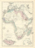

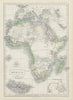


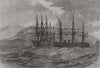

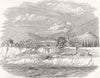


Madeira's Atlantic position comes through vividly in these antique maps and views, with Funchal and its busy harbour as the recurring point of arrival. Robert Morden's early eighteenth-century geography, Bellin's map of Madeira and Porto Santo and Stanford's more detailed mapping trace the island's mountains, rivers and principal settlements, while regional atlas sheets set the Portuguese archipelago beside the Canaries, Azores and other Atlantic groups. The prints give particular attention to Funchal, and among the town and landscape views is a scene of submarine-cable laying that marks the island's place in nineteenth-century communications.
EU orders up to €150 are sent VAT- and duty-paid — no additional taxes on arrival
Authenticity Guaranteed - We only sell original antique & vintage items
Can we help? Call us on +44-208-960-3476 • FAQs
All our products are exempt from US tariffs — no additional duties or taxes payable on arrival.


- Shop by Country
- Shop by Cartographer
- Shop Maps by Type
- Shop Prints by Subject