


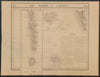


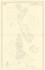

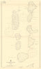

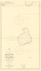


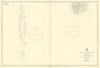


Coral atolls, reefs and sea passages give these maps of the Maldives a form in which water fills far more of the sheet than land. Mallet and Morden set the islands beside Ceylon and southern India, while Bellin and Vandermaelen focus on the archipelago itself. Later charts associated with Horsburgh, Walker and the East India Company divide the chain into navigational sections, picking out reefs, channels and atoll groups such as Male, Ari and Maalhosmadulu. The prints add island views and flags, including the royal standard and later national emblems.
EU orders up to €150 are sent VAT- and duty-paid — no additional taxes on arrival
Authenticity Guaranteed - We only sell original antique & vintage items
Can we help? Call us on +44-208-960-3476 • FAQs
All our products are exempt from US tariffs — no additional duties or taxes payable on arrival.


- Shop by Country
- Shop by Cartographer
- Shop Maps by Type
- Shop Prints by Subject