


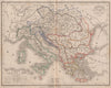


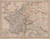

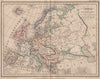


Twin hemispheres, continents and the nations of Europe and the Middle East are drawn in compact form in these maps by Achille Meissas (1799–1874), the French geographical author, from the Petit atlas universel he published with Michelot through Hachette in Paris in 1861. The sheets range from the world and the continents to the British Isles, Iberia, central Europe and the Middle East, in outline colour with French names. Some still show an earlier political map, including the Republic of Texas and Austrian Venice, a sign of established plates kept in use for this school atlas.
EU orders up to €150 are sent VAT- and duty-paid — no additional taxes on arrival
Authenticity Guaranteed - We only sell original antique & vintage items
Can we help? Call us on +44-208-960-3476 • FAQs
All our products are exempt from US tariffs — no additional duties or taxes payable on arrival.


- Shop by Country
- Shop by Cartographer
- Shop Maps by Type
- Shop Prints by Subject