


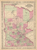


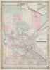


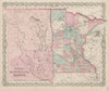


The headwaters of the Mississippi and the growth of the Twin Cities anchor these maps and prints of Minnesota. Territorial surveys, government roads and atlas sheets by Colton and Johnson are followed by state, county, railway and highway maps, land-cession maps record Dakota and Ojibwe territories, and plans of Minneapolis, St Paul and Duluth show the developing cities. The prints follow St Anthony Falls, Minnehaha, Lake Pepin and Fort Snelling, and Catlin's Native American subjects include portraits, dances and the pipestone quarry. Civic buildings, libraries, parks and streets show Minneapolis and St Paul up close, down to winter scenes on Summit Avenue.
EU orders up to €150 are sent VAT- and duty-paid — no additional taxes on arrival
Authenticity Guaranteed - We only sell original antique & vintage items
Can we help? Call us on +44-208-960-3476 • FAQs
All our products are exempt from US tariffs — no additional duties or taxes payable on arrival.


- Shop by Country
- Shop by Cartographer
- Shop Maps by Type
- Shop Prints by Subject