


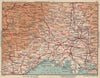


Montpellier, the capital of Hérault, has been mapped since Sebastian Münster published his view of the city in 1572. Malte-Brun's departmental map of 1852 and a later one of 1902 carry inset plans of the city, and town plans of 1881, 1899, 1907, 1914 and 1954 trace the streets of the medieval Écusson and the quarters around it. A sketch map of 1885 charts high and low death rates along the Hérault coast, and a vintage sheet of 1954 sets the city beside Nîmes, the Cévennes and the Camargue. The prints show the cathedral, the Palais de Justice and wider views of the town.
EU orders up to €150 are sent VAT- and duty-paid — no additional taxes on arrival
Authenticity Guaranteed - We only sell original antique & vintage items
Can we help? Call us on +44-208-960-3476 • FAQs
All our products are exempt from US tariffs — no additional duties or taxes payable on arrival.


- Shop by Country
- Shop by Cartographer
- Shop Maps by Type
- Shop Prints by Subject