


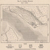

Island fortifications and the Zambezi delta set the scene in these maps of Mozambique, beginning with early charts of Mozambique Island, its harbour and the fort of São Sebastião. Broader sheets show Sofala, the Mutapa kingdom and Portuguese East Africa, later exploration maps follow the Rovuma, the Lugenda and the routes to Lake Nyasa, and regional maps track the changing colonial boundaries. Maputo appears as Lourenço Marques, with plans and views of the bay and the railway to South Africa. The prints show coastal settlements, customs houses, river expeditions and the suppression of the slave trade, and the collection reaches the independence era with solidarity imagery.
EU orders up to €150 are sent VAT- and duty-paid — no additional taxes on arrival
Authenticity Guaranteed - We only sell original antique & vintage items
Can we help? Call us on +44-208-960-3476 • FAQs
All our products are exempt from US tariffs — no additional duties or taxes payable on arrival.


- Shop by Country
- Shop by Cartographer
- Shop Maps by Type
- Shop Prints by Subject