


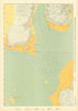

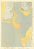


Projecting into the North Channel at the southern tip of the Kintyre peninsula, the Mull of Kintyre faces the sea approaches between Scotland and Ulster, and its maps and prints are full of ships, signals and strategy. A lighthouse was established on the headland in 1788, and John Cary's antique sheets of 1794 and 1824 show it opposite Larne and Ballycastle, with Campbeltown under the older spelling Cambelton. An 1893 map widens the view to Islay, Jura, Arran, Gigha and Loch Fyne. Two prints of 1887 follow naval exercises around the Mull of Cantyre, as it was then written, with a signal fire lit to warn torpedo boats and C Squadron trying to force a way past. Most striking are the Kriegsmarine sheets of 1940, paired maps of the North Channel and Firth of Clyde recording ground type, hardness and stone deposits.
EU orders up to €150 are sent VAT- and duty-paid — no additional taxes on arrival
Authenticity Guaranteed - We only sell original antique & vintage items
Can we help? Call us on +44-208-960-3476 • FAQs
All our products are exempt from US tariffs — no additional duties or taxes payable on arrival.


- Shop by Country
- Shop by Cartographer
- Shop Maps by Type
- Shop Prints by Subject