
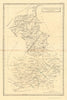


From Elizabethan London reconstructed on paper to the caravan routes of North Africa, the Neele family engraved maps for a wide range of publications between 1793 and about 1818. Samuel John Neele, who lived from 1758 to 1824, is named on plans of Cambridgeshire and Cambridge, and a North African sheet carries the joint attribution S. & G. Neele. The East Riding of Yorkshire and the Ainsty add county geography, and the map of London and Westminster shows the city as it was in 1563, though it was printed in the eighteenth century.
EU orders up to €150 are sent VAT- and duty-paid — no additional taxes on arrival
Authenticity Guaranteed - We only sell original antique & vintage items
Can we help? Call us on +44-208-960-3476 • FAQs
All our products are exempt from US tariffs — no additional duties or taxes payable on arrival.


- Shop by Country
- Shop by Cartographer
- Shop Maps by Type
- Shop Prints by Subject