


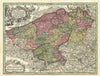


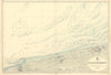


Fortress towns, Channel approaches and First World War battlefields give these maps of Nord, the French department on the Belgian frontier, a strongly military and maritime character. Older sheets show it as part of Flanders, later ones as an administrative region in its own right. Plans of Lille, Cambrai, Maubeuge, Condé and Valenciennes examine the fortified towns, earlier siege plans among them, and coastal charts follow Dunkirk and the Channel approaches. Retrospective campaign maps of the fighting around Le Cateau, Cambrai and the Lys mark positions, barrages and movements, and prints add urban subjects and illustrated accounts of events in the region.
EU orders up to €150 are sent VAT- and duty-paid — no additional taxes on arrival
Authenticity Guaranteed - We only sell original antique & vintage items
Can we help? Call us on +44-208-960-3476 • FAQs
All our products are exempt from US tariffs — no additional duties or taxes payable on arrival.


- Shop by Country
- Shop by Cartographer
- Shop Maps by Type
- Shop Prints by Subject