
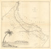


Coastlines, mountain journeys and the coming of the telegraph shape this collection of maps and prints of Oman. Vandermaelen's regional atlas sheets lead on to the Royal Geographical Society map of James Wellsted's journey and later sketch maps of Muscat, its highlands and the Musandam peninsula, with a Cold War escape map carrying the sequence into the twentieth century. The prints show Elphinstone Inlet, a telegraph cable being landed at Muscat, local sailing vessels and military action on the Gulf coast, and a national flag plate adds a later emblem.
EU orders up to €150 are sent VAT- and duty-paid — no additional taxes on arrival
Authenticity Guaranteed - We only sell original antique & vintage items
Can we help? Call us on +44-208-960-3476 • FAQs
All our products are exempt from US tariffs — no additional duties or taxes payable on arrival.


- Shop by Country
- Shop by Cartographer
- Shop Maps by Type
- Shop Prints by Subject