


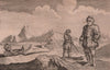


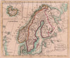


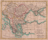
Revolutionary France, partitioned Poland and Cook’s voyages all feature in these antique maps by John Payne, taken from his Universal Geography of 1791 and the later Payne’s Geography. Payne compiled the works, which does not make him the engraver of every plate. The maps show France divided into departments, Poland after partition, the Swiss cantons, Russia, the Low Countries and Scandinavia with an inset of Iceland, together with a world chart on Mercator’s projection tracing Cook’s route. Illustrations show the destruction of the Bastille, a palace in St Petersburg and travel among the Sámi, called Laplanders in the original caption.
EU orders up to €150 are sent VAT- and duty-paid — no additional taxes on arrival
Authenticity Guaranteed - We only sell original antique & vintage items
Can we help? Call us on +44-208-960-3476 • FAQs
All our products are exempt from US tariffs — no additional duties or taxes payable on arrival.


- Shop by Country
- Shop by Cartographer
- Shop Maps by Type
- Shop Prints by Subject