


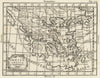


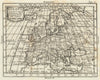


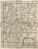


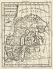


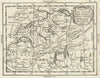


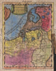
California drawn as an island and Italian captions naming Muscovy, the Holy Roman Empire and the Ottoman territories give these maps by Giovanni Petroschi a vivid eighteenth-century character. Petroschi, who lived from 1715 to 1766, was an engraver, and the maps here were issued in a later edition of Buffier's Geografia Universale, published in Venice in 1788, so the date records the later use of his copperplates rather than work done in his lifetime. They range from a world map and continental sheets to individual European countries and regions, with the Americas, Asia and Africa keeping other features inherited from earlier geographical models.
EU orders up to €150 are sent VAT- and duty-paid — no additional taxes on arrival
Authenticity Guaranteed - We only sell original antique & vintage items
Can we help? Call us on +44-208-960-3476 • FAQs
All our products are exempt from US tariffs — no additional duties or taxes payable on arrival.


- Shop by Country
- Shop by Cartographer
- Shop Maps by Type
- Shop Prints by Subject