
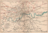

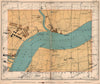

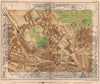

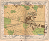

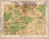

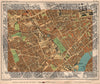

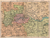


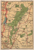


Interwar London, street by street and line by line, fills these maps from Philip's Handy-Volume Atlas of London, here from the ninth edition of 1932. Published by George Philip and Son, the atlas divided the capital into portable reference sheets and added wider maps of London and the Home Counties. District coverage runs from Brondesbury and Hampstead to the marshes and riverside industry of the east, and south to Chislehurst and Sidcup, while City sheets mark public buildings and commercial institutions. Separate railway maps show the main company groups and the Underground lines just before London's transport was reorganised later in the decade.
EU orders up to €150 are sent VAT- and duty-paid — no additional taxes on arrival
Authenticity Guaranteed - We only sell original antique & vintage items
Can we help? Call us on +44-208-960-3476 • FAQs
All our products are exempt from US tariffs — no additional duties or taxes payable on arrival.


- Shop by Country
- Shop by Cartographer
- Shop Maps by Type
- Shop Prints by Subject