


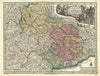


Waldensian valleys and Alpine passes take these maps of Piedmont well beyond Turin. Early regional sheets show the region beside Savoy, Montferrat and neighbouring Italian states, while later maps record its place in the Kingdom of Sardinia and the changes of Italian unification. Mountain maps follow Susa, the Graian Alps and the approaches to France, and ski panoramas show twentieth-century resorts such as Sestriere. The prints include Bartlett's views of Torre Pellice, Bobbio, Prali and other valley communities, with their Protestant churches and village life, alongside Turin's rivers and streets and images of annexation ceremonies elsewhere in Italy linked to Piedmont's nineteenth-century expansion.
EU orders up to €150 are sent VAT- and duty-paid — no additional taxes on arrival
Authenticity Guaranteed - We only sell original antique & vintage items
Can we help? Call us on +44-208-960-3476 • FAQs
All our products are exempt from US tariffs — no additional duties or taxes payable on arrival.


- Shop by Country
- Shop by Cartographer
- Shop Maps by Type
- Shop Prints by Subject