


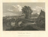


The Eden rises in Mallerstang and flows north towards the Solway, linking the upland fells with the border city of Carlisle, and its maps and prints follow the valley down to the city. An 1816 view of Carlisle from Stanwix shows the old Eden Bridge, and prints of 1908 find the river at Samson's Chamber near Carlisle and in quieter country near Lazonby. Smith's map of 1746 traces the route of the rebels through the country around Carlisle, and the Ordnance Survey sheet of 1878 covers the Eden valley with Penrith, Appleby, the North Pennines and the Orton Fells. A print of 1901 shows Eden Hall.
EU orders up to €150 are sent VAT- and duty-paid — no additional taxes on arrival
Authenticity Guaranteed - We only sell original antique & vintage items
Can we help? Call us on +44-208-960-3476 • FAQs
All our products are exempt from US tariffs — no additional duties or taxes payable on arrival.


- Shop by Country
- Shop by Cartographer
- Shop Maps by Type
- Shop Prints by Subject