


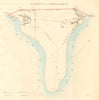
Rosemarkie is represented by the 1832 Dawson Reform Act borough plan shared with Fortrose, and Taylor and Skinner’s 1776 road-strip map through Dingwall, Tain, Cromarty, Fortrose and Inverness. Together they record the settlement’s burgh boundaries and its position on the historic Black Isle road network.
EU orders up to €150 are sent VAT- and duty-paid — no additional taxes on arrival
Authenticity Guaranteed - We only sell original antique & vintage items
Can we help? Call us on +44-208-960-3476 • FAQs
All our products are exempt from US tariffs — no additional duties or taxes payable on arrival.


- Shop by Country
- Shop by Cartographer
- Shop Maps by Type
- Shop Prints by Subject