


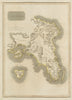

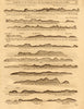

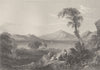


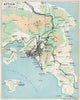








Antique maps, old maps and prints of the Saronic Islands and neighbouring Argolic waters, often grouped as the Argosaronic Islands. Historical sheets use Golfe Saronique and Gulf of Aegina or Engia. Browse island and gulf charts, battle plans and views, with collections for Salamis, Aegina, Hydra, Poros and Spetses. The buttons lead to the three largest islands. Explore Greece for wider regional material.
EU orders up to €150 are sent VAT- and duty-paid — no additional taxes on arrival
Authenticity Guaranteed - We only sell original antique & vintage items
Can we help? Call us on +44-208-960-3476 • FAQs
All our products are exempt from US tariffs — no additional duties or taxes payable on arrival.


- Shop by Country
- Shop by Cartographer
- Shop Maps by Type
- Shop Prints by Subject