


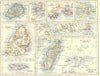


From Mahé and Praslin to the far-flung outer islands of the western Indian Ocean, these maps chart the Seychelles across two centuries. Sayer and Bennett's eighteenth-century chart joins Mahé with the Amirantes, Waterlow's later maps show the islands more closely, and Admiralty charts reach Aldabra, Farquhar and Cosmoledo, while regional atlas sheets place the whole archipelago in its ocean setting. The prints show Victoria and St Paul's Church and record liberated people being landed from HMS Lyra, a moment of nineteenth-century maritime history. Colonial badges and later national flags trace the changing symbols of government.
EU orders up to €150 are sent VAT- and duty-paid — no additional taxes on arrival
Authenticity Guaranteed - We only sell original antique & vintage items
Can we help? Call us on +44-208-960-3476 • FAQs
All our products are exempt from US tariffs — no additional duties or taxes payable on arrival.


- Shop by Country
- Shop by Cartographer
- Shop Maps by Type
- Shop Prints by Subject