Skip to content
Your cart is empty
Continue shopping

Have an account?

Log in to check out faster.

Your cart

Loading...

Estimated total

£0.00 GBP

Taxes included. Discounts and shipping calculated at checkout.
EU orders up to €150 are sent VAT- and duty-paid — no additional taxes on arrival
Authenticity Guaranteed - We only sell original antique & vintage items
Can we help? Call us on +44-208-960-3476 • FAQs
All our products are exempt from US tariffs — no additional duties or taxes payable on arrival.
  • What's New
  • Shop Maps & Prints
    • Shop by Country

    • Shop by Cartographer

    • Shop Maps by Type

    • Shop Prints by Subject

    • Best Maps
    • FAQs
    • Africa
      • South Africa
      • Egypt
      Asia
      • India
      • China
      • Malaysia & Singapore
      • Hong Kong
      • Indonesia
      Australasia
      • Australia
      • New Zealand
    • British Isles
      • England
        • Cornwall
        • Devon
        • Kent
        • Lancashire
        • London
        • Oxfordshire
        • Yorkshire
        • Surrey
        • Sussex
      • Ireland
      • Scotland
      • Wales
    • Europe
      • Austria
      • France
      • Germany
      • Greece
      • Italy
      • Malta
      • Netherlands
      • Norway
      • Poland
      • Portugal
      • Russia
      • Spain
      • Switzerland
    • Middle East
      • Israel / Palestine
      • Iran
      • Saudi Arabia
      North America
      • Canada
      • United States
      • California
      • Florida
      • Illinois
      • New York
      • Pennsylvania
      • Texas
    • Polar Regions South & Central America
      • Mexico
      • Brazil
      Oceans & Islands
      • Pacific
      • Atlantic
      • Caribbean
      • Indian
      World
    • Shop All Countries

    • A-B
      • Admiralty (British)
      • Bacon, George Washington
      • Beck, Harry
      • Bellin, Jacques-Nicolas
      • Booth, Charles
      C-G
      • Cary, John
      • Collins, Greenville
      • Colton, Joseph Hutchins
      • Faden, William
      • Geographia
    • H-J
      • H.M.S.O.
      • Hall, Sidney
      • Hétreau, Rémy
      • Japanese Government Railways
      • Johnson, Alvin Jewett
      K-L
      • Langenes, Barent
      • Lewis, Samuel & Creighton, Roger
      • Keere, Pieter van den
      • Larmat, Louis
      • Lodge, John
    • M-O
      • Mallet, Allain Manesson
      • Moll, Hermann
      • Morden, Robert
      • Munster, Sebastian
      • Ordnance Survey
      P-S
      • Porcacchi, Tomaso
      • Rossi, Giovanni Giacomo de
      • S.D.U.K.
      • Speed, John
      • Stanford, Edward
    • T-V
      • Tallis, John
      • Thomson, John
      • Tolkien, J.R.R.
      • Vandermaelen, Philippe
      • Vaugondy, Robert de
      W-Z
      • Walker, John & Charles
      • Ward Lock & Co
      • Weller, Edward
      • Wyld, James
    • Shop All Cartographers

    • Wine Maps Road Strip Maps Pictorial Maps Town & City Plans
      • Neighbourhood Maps
      • City of London Ward Maps
      • London Parish Maps
      • Insurance Maps
      • London Underground Maps
    • Panoramic Maps Nautical Charts Geological Maps Provincial Maps
      • British Isles County Maps
      • US State Maps
      • French Department Maps
    • Fantasy Maps Star charts Tour de France maps Military Maps
      • American Revolutionary War
      • American Civil War
      • First World War
      • Second World War
    • Animals & Birds
      • Birds
      • Butterflies & Moths
      • Dogs
      • Fish & Marine Animals
      Astronomy & Celestial Botanical & Florals Cartoons, Fantasy & Fairy Tales
      • Flower Fairies
      • Vanity Fair Spy Cartoons
    • Flags & Vexillology Landscapes & Seascapes Military & Naval People, Portraits & Fashion
      • Celebrities & Royalty
      • Children & Family
      • Fashion & Traditional Dress
      • Religion
      • Society
      • Tribal
    • Religious Buildings Ships & Maritime Sports & Hobbies
      • Golf
      • Cricket
      • Riding, Hunting & Shooting
      • Horse Racing & Jockeys
      • Sailing
      • Rowing
      • Polo
      • Athletics
    • Trade & Professions
      • Business & Industry
      • Education
      • Engineering & Science
      • Farming & Fishermen
      • Law
      • Literary
      • Medicine
      • Performing Arts
      Town Views
    • Shop All Subjects

  • About
  • Contact
Antiquemapsandprints.com Antiquemapsandprints.com
  • Cart
Antiquemapsandprints.com
  • Shop by Country
    • Shop All Countries
    • Africa
      • South Africa
      • Egypt
    • Asia
      • India
      • China
      • Malaysia & Singapore
      • Hong Kong
      • Indonesia
    • Australasia
      • Australia
      • New Zealand
    • British Isles
      • England
        • Cornwall
        • Devon
        • Kent
        • Lancashire
        • London
        • Oxfordshire
        • Yorkshire
        • Surrey
        • Sussex
      • Ireland
      • Scotland
      • Wales
    • Europe
      • Austria
      • France
      • Germany
      • Greece
      • Italy
      • Malta
      • Netherlands
      • Norway
      • Poland
      • Portugal
      • Russia
      • Spain
      • Switzerland
    • Middle East
      • Israel / Palestine
      • Iran
      • Saudi Arabia
    • North America
      • Canada
      • United States
      • California
      • Florida
      • Illinois
      • New York
      • Pennsylvania
      • Texas
    • Polar Regions
    • South & Central America
      • Mexico
      • Brazil
    • Oceans & Islands
      • Pacific
      • Atlantic
      • Caribbean
      • Indian
    • World
  • Shop by Cartographer
    • Shop All Cartographers
    • A-B
      • Admiralty (British)
      • Bacon, George Washington
      • Beck, Harry
      • Bellin, Jacques-Nicolas
      • Booth, Charles
    • C-G
      • Cary, John
      • Collins, Greenville
      • Colton, Joseph Hutchins
      • Faden, William
      • Geographia
    • H-J
      • H.M.S.O.
      • Hall, Sidney
      • Hétreau, Rémy
      • Japanese Government Railways
      • Johnson, Alvin Jewett
    • K-L
      • Langenes, Barent
      • Lewis, Samuel & Creighton, Roger
      • Keere, Pieter van den
      • Larmat, Louis
      • Lodge, John
    • M-O
      • Mallet, Allain Manesson
      • Moll, Hermann
      • Morden, Robert
      • Munster, Sebastian
      • Ordnance Survey
    • P-S
      • Porcacchi, Tomaso
      • Rossi, Giovanni Giacomo de
      • S.D.U.K.
      • Speed, John
      • Stanford, Edward
    • T-V
      • Tallis, John
      • Thomson, John
      • Tolkien, J.R.R.
      • Vandermaelen, Philippe
      • Vaugondy, Robert de
    • W-Z
      • Walker, John & Charles
      • Ward Lock & Co
      • Weller, Edward
      • Wyld, James
  • Shop Maps by Type
    • Wine Maps
    • Road Strip Maps
    • Pictorial Maps
    • Town & City Plans
      • Neighbourhood Maps
      • City of London Ward Maps
      • London Parish Maps
      • Insurance Maps
      • London Underground Maps
    • Panoramic Maps
    • Nautical Charts
    • Geological Maps
    • Provincial Maps
      • British Isles County Maps
      • US State Maps
      • French Department Maps
    • Fantasy Maps
    • Star charts
    • Tour de France maps
    • Military Maps
      • American Revolutionary War
      • American Civil War
      • First World War
      • Second World War
  • Shop Prints by Subject
    • Shop All Subjects
    • Animals & Birds
      • Birds
      • Butterflies & Moths
      • Dogs
      • Fish & Marine Animals
    • Astronomy & Celestial
    • Botanical & Florals
    • Cartoons, Fantasy & Fairy Tales
      • Flower Fairies
      • Vanity Fair Spy Cartoons
    • Flags & Vexillology
    • Landscapes & Seascapes
    • Military & Naval
    • People, Portraits & Fashion
      • Celebrities & Royalty
      • Children & Family
      • Fashion & Traditional Dress
      • Religion
      • Society
      • Tribal
    • Religious Buildings
    • Ships & Maritime
    • Sports & Hobbies
      • Golf
      • Cricket
      • Riding, Hunting & Shooting
      • Horse Racing & Jockeys
      • Sailing
      • Rowing
      • Polo
      • Athletics
    • Trade & Professions
      • Business & Industry
      • Education
      • Engineering & Science
      • Farming & Fishermen
      • Law
      • Literary
      • Medicine
      • Performing Arts
    • Town Views
  • Best Maps
  • What's New
  • About
  • Contact
  • Account

South America

  • Forrest, Archibald Stevenson
  • Brazil
  • Argentina
Filter
Clear
Filter
Filter
Sort
Clear All

Showing 907 of 907 products Showing 907 of 907

Sort
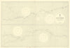
  • River Amazon. Gurupa - Iquitos. Brazil Peru. ADMIRALTY sea chart 1910 (1953) map River Amazon. Gurupa - Iquitos. Brazil Peru. ADMIRALTY sea chart 1910 (1953) map
    River Amazon. Gurupa - Iquitos. Brazil Peru. ADMIRALTY sea chart 1910 (1953) map

    Sold

  • SOUTH AMERICA. Tallis. Decorative. Vignettes. Original Outline Colour 1853 map SOUTH AMERICA. Tallis. Decorative. Vignettes. Original Outline Colour 1853 map
    SOUTH AMERICA. Tallis. Decorative. Vignettes. Original Outline Colour 1853 map

    Sold

  • Countries on the South Sea… KITCHIN. Colombia Ecuador Panama. French ed 1778 map Countries on the South Sea… KITCHIN. Colombia Ecuador Panama. French ed 1778 map
    Countries on the South Sea… KITCHIN. Colombia Ecuador Panama. French ed 1778 map

    Sold

  • Johnson's Central America. Guatemala Honduras Nicaragua Costa Rica 1861 map Johnson's Central America. Guatemala Honduras Nicaragua Costa Rica 1861 map
    Johnson's Central America. Guatemala Honduras Nicaragua Costa Rica 1861 map

    Sold

  • PATAGONIA. Argentina Chile Tierra del Fuego Falklands S Georgia SDUK 1844 map PATAGONIA. Argentina Chile Tierra del Fuego Falklands S Georgia SDUK 1844 map
    PATAGONIA. Argentina Chile Tierra del Fuego Falklands S Georgia SDUK 1844 map

    Sold

  • PATAGONIA. Argentina Chile Tierra del Fuego Falklands S Georgia.SDUK 1844 map PATAGONIA. Argentina Chile Tierra del Fuego Falklands S Georgia.SDUK 1844 map
    PATAGONIA. Argentina Chile Tierra del Fuego Falklands S Georgia.SDUK 1844 map

    Sold

  • PATAGONIA. Argentina Chile Tierra del Fuego Falklands S Georgia. SDUK 1851 map PATAGONIA. Argentina Chile Tierra del Fuego Falklands S Georgia. SDUK 1851 map
    PATAGONIA. Argentina Chile Tierra del Fuego Falklands S Georgia. SDUK 1851 map

    Sold

  • South America /Atlantic Ocean. Gran Colombia. United Provinces. LIZARS 1842 map South America /Atlantic Ocean. Gran Colombia. United Provinces. LIZARS 1842 map
    South America /Atlantic Ocean. Gran Colombia. United Provinces. LIZARS 1842 map

    Sold

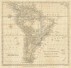
  • South America with its Political Divisions. BAKER / BOURNE 1806 old map South America with its Political Divisions. BAKER / BOURNE 1806 old map
    South America with its Political Divisions. BAKER / BOURNE 1806 old map

    Sold

  • West Indies… English, French, Spanish, Dutch & Danish settlements BOWEN 1789 map West Indies… English, French, Spanish, Dutch & Danish settlements BOWEN 1789 map
    West Indies… English, French, Spanish, Dutch & Danish settlements BOWEN 1789 map

    Sold

  • "La Terra Ferma, la Gujana…". Venezuela Colombia Ecuador Guianas. ZATTA 1785 map

    Sold

  • 'Amerique Méridionale'. South America. BELLIN/SCHLEY 1772 old antique map 'Amerique Méridionale'. South America. BELLIN/SCHLEY 1772 old antique map
    'Amerique Méridionale'. South America. BELLIN/SCHLEY 1772 old antique map

    Sold

  • Brazil Uruguay coast. Florianopolis-River Plate. Admiralty sea chart 1901 map Brazil Uruguay coast. Florianopolis-River Plate. Admiralty sea chart 1901 map
    Brazil Uruguay coast. Florianopolis-River Plate. Admiralty sea chart 1901 map

    Sold

  • PERU & BOLIVIA. Bolivia with Atacama litoral.Potosi view RAPKIN/TALLIS 1851 map PERU & BOLIVIA. Bolivia with Atacama litoral.Potosi view RAPKIN/TALLIS 1851 map
    PERU & BOLIVIA. Bolivia with Atacama litoral.Potosi view RAPKIN/TALLIS 1851 map

    Sold

  • SOUTH AMERICA. Amerique Meridionale Brazil Chile Argentina Peru. MALLET 1683 map SOUTH AMERICA. Amerique Meridionale Brazil Chile Argentina Peru. MALLET 1683 map
    SOUTH AMERICA. Amerique Meridionale Brazil Chile Argentina Peru. MALLET 1683 map

    Sold

  • 'South America'. La Plata Bolivia w/ littoral New Granada. ETTLING 1862 map 'South America'. La Plata Bolivia w/ littoral New Granada. ETTLING 1862 map
    'South America'. La Plata Bolivia w/ littoral New Granada. ETTLING 1862 map

    Sold

  • Día del Guerrillero Heroico. Che Guevara. Cuban propaganda poster. OSPAAAL 1968 Día del Guerrillero Heroico. Che Guevara. Cuban propaganda poster. OSPAAAL 1968
    Día del Guerrillero Heroico. Che Guevara. Cuban propaganda poster. OSPAAAL 1968

    Sold

  • PATAGONIA Argentina Chile Tierra del Fuego Falklands South Georgia SDUK 1844 map PATAGONIA Argentina Chile Tierra del Fuego Falklands South Georgia SDUK 1844 map
    PATAGONIA Argentina Chile Tierra del Fuego Falklands South Georgia SDUK 1844 map

    Sold

  • South America & Falklands war exclusion zone chart HMS Glamorgan 1966 (1982) map South America & Falklands war exclusion zone chart HMS Glamorgan 1966 (1982) map
    South America & Falklands war exclusion zone chart HMS Glamorgan 1966 (1982) map

    Sold

  • "Spanish North America, southern part" by John Thomson. Central America 1830 map

    Sold

  • 'Carte des Provinces de Nicaragua & Costa Rica'. Central America BELLIN 1754 map 'Carte des Provinces de Nicaragua & Costa Rica'. Central America BELLIN 1754 map
    'Carte des Provinces de Nicaragua & Costa Rica'. Central America BELLIN 1754 map

    Sold

  • A Map of South America, drawn from the Latest & Best Authorities. LODGE 1780 A Map of South America, drawn from the Latest & Best Authorities. LODGE 1780
    A Map of South America, drawn from the Latest & Best Authorities. LODGE 1780

    Sold

  • Colony of British Honduras. Belize. WASHINGTON EVES 1889 old antique map chart Colony of British Honduras. Belize. WASHINGTON EVES 1889 old antique map chart
    Colony of British Honduras. Belize. WASHINGTON EVES 1889 old antique map chart

    Sold

  • PATAGONIA Argentina Chile Tierra del Fuego Falklands South Georgia SDUK 1874 map PATAGONIA Argentina Chile Tierra del Fuego Falklands South Georgia SDUK 1874 map
    PATAGONIA Argentina Chile Tierra del Fuego Falklands South Georgia SDUK 1874 map

    Sold

  • PATAGONIA. Argentina Chile Tierra del Fuego Falklands S Georgia. SDUK 1846 map PATAGONIA. Argentina Chile Tierra del Fuego Falklands S Georgia. SDUK 1846 map
    PATAGONIA. Argentina Chile Tierra del Fuego Falklands S Georgia. SDUK 1846 map

    Sold

  • PATAGONIA. Argentina Chile Tierra del Fuego Falklands S Georgia.SDUK 1848 map PATAGONIA. Argentina Chile Tierra del Fuego Falklands S Georgia.SDUK 1848 map
    PATAGONIA. Argentina Chile Tierra del Fuego Falklands S Georgia.SDUK 1848 map

    Sold

  • "Il Paraguai e parte dei paesi adiacenti" Uruguay Paraguay Brazil ZATTA 1785 map

    Sold

  • 'Cartagène, Ste. Marthe et Venezuela'. Colombia. Cartagena. BELLIN 1754 map 'Cartagène, Ste. Marthe et Venezuela'. Colombia. Cartagena. BELLIN 1754 map
    'Cartagène, Ste. Marthe et Venezuela'. Colombia. Cartagena. BELLIN 1754 map

    Sold

  • 'Carte des Provinces de Nicaragua et Costa Rica'. BELLIN/SCHLEY 1758 old map 'Carte des Provinces de Nicaragua et Costa Rica'. BELLIN/SCHLEY 1758 old map
    'Carte des Provinces de Nicaragua et Costa Rica'. BELLIN/SCHLEY 1758 old map

    Sold

  • 'Paraguay et des pays voisins'. Central South America. BELLIN 1758 old map 'Paraguay et des pays voisins'. Central South America. BELLIN 1758 old map
    'Paraguay et des pays voisins'. Central South America. BELLIN 1758 old map

    Sold

  • 'Tabasco, Chiapa, Verapaz, Guatimala, Honduras & Yucatan' BELLIN/SCHLEY 1758 map 'Tabasco, Chiapa, Verapaz, Guatimala, Honduras & Yucatan' BELLIN/SCHLEY 1758 map
    'Tabasco, Chiapa, Verapaz, Guatimala, Honduras & Yucatan' BELLIN/SCHLEY 1758 map

    Sold

  • AMÉRIQUE MERIDIONALE. South America. Antique map/carte. LEVASSEUR 1852 old AMÉRIQUE MERIDIONALE. South America. Antique map/carte. LEVASSEUR 1852 old
    AMÉRIQUE MERIDIONALE. South America. Antique map/carte. LEVASSEUR 1852 old

    Sold

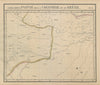
  • Amér Mér Colombie & Brésil 9 Peru Colombia Amazonas Brazil VANDERMAELEN 1827 map Amér Mér Colombie & Brésil 9 Peru Colombia Amazonas Brazil VANDERMAELEN 1827 map
    Amér Mér Colombie & Brésil 9 Peru Colombia Amazonas Brazil VANDERMAELEN 1827 map

    Sold

  • An accurate map of South America, from the best modern maps… BOWEN 1789 An accurate map of South America, from the best modern maps… BOWEN 1789
    An accurate map of South America, from the best modern maps… BOWEN 1789

    Sold

  • SOUTH AMERICA. La Plata. Brazil Peru Chile Patagonia Tribes. MALLET 1683 map SOUTH AMERICA. La Plata. Brazil Peru Chile Patagonia Tribes. MALLET 1683 map
    SOUTH AMERICA. La Plata. Brazil Peru Chile Patagonia Tribes. MALLET 1683 map

    Sold

  • South America. Brazil La Plata Peru Equador Chili Uruguay. COWPERTHWAIT 1852 map South America. Brazil La Plata Peru Equador Chili Uruguay. COWPERTHWAIT 1852 map
    South America. Brazil La Plata Peru Equador Chili Uruguay. COWPERTHWAIT 1852 map

    Sold

  • 1
  • …
  • 14
  • 15
  • 16
  • 17
  • 18
  • …
  • 26
Back to Top

Be the first to explore our new discoveries.

Sign up for early access to rare finds and special offers.

2026 Antiqua Print Gallery Ltd. All rights Reserved.
  • Antiqua Print Gallery Ltd
    • Suite 204, Cumberland House 80 Scrubs Lane London NW10 6RF
    • +44 (0)208 960 3476
    • info@antiquemapsandprints.com
  • Shop By
    • Country
    • Cartographer
    • Subject
  • Discover
    • About Us
    • Blog
    • Contact Us
    • Sell to Us
    • FAQs
  • Social
    • Facebook
    • Instagram
    • Pinterest
  • Privacy Policy
  • Cookies
  • Returns
  • Delivery
  • Terms & Conditions
  • Website by Radiant
    • Website by Radiant
    • Privacy Policy
    • Cookies
    • Returns
    • Delivery
    • Terms & Conditions
  • Payment methods
    • American Express
    • Apple Pay
    • Bancontact
    • Diners Club
Payment methods
  • American Express
  • Apple Pay
  • Bancontact
  • Diners Club
2026 Antiqua Print Gallery Ltd. All rights Reserved.
  • Choosing a selection results in a full page refresh.
  • Opens in a new window.