
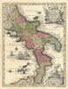


Naples, Sicily and the great ancient sites of the south fill these maps of Southern Italy, from broad political geography to the detail a traveller needed on the ground. Seutter's map of the Kingdom of Naples shows the whole political landscape, and later maps follow the Bay of Naples, Vesuvius, Ischia and the Amalfi coast. Baedeker plans of Pompeii, Selinunte and Segesta mark the ruins and how to approach them, and city plans run through Bari, Brindisi, Catania, Syracuse and other southern centres, with island and town maps of Sardinia. Coastal and inland sheets link the ports, roads and settlements in between.
EU orders up to €150 are sent VAT- and duty-paid — no additional taxes on arrival
Authenticity Guaranteed - We only sell original antique & vintage items
Can we help? Call us on +44-208-960-3476 • FAQs
All our products are exempt from US tariffs — no additional duties or taxes payable on arrival.


- Shop by Country
- Shop by Cartographer
- Shop Maps by Type
- Shop Prints by Subject