


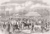


Stamford is a town of stone churches at a crossing of the Welland, with Burghley House at its edge, and a stage on the road north from Stilton to Grantham and Newark. Saunders's engravings of 1836 picture St Mary's and St Michael's churches, St Leonard's Priory and the hospital, and later prints add the station on the Essendine railway, the race cup, St George's Square and general views of the town. Burghley has a group of its own, with the house, a farmers' show and a wedding celebration. The road maps begin with Ogilby in 1675 and continue with Gardner, Owen and Bowen and Paterson. Dawson's plans of 1832 and 1837 and Boundary Commission sheets of 1868 and 1888 show the borough, while Morden's Rutland of 1695 and the Ordnance Survey of 1824 cover the country around.
EU orders up to €150 are sent VAT- and duty-paid — no additional taxes on arrival
Authenticity Guaranteed - We only sell original antique & vintage items
Can we help? Call us on +44-208-960-3476 • FAQs
All our products are exempt from US tariffs — no additional duties or taxes payable on arrival.


- Shop by Country
- Shop by Cartographer
- Shop Maps by Type
- Shop Prints by Subject