
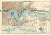

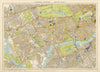

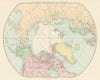

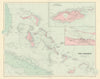

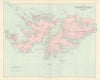

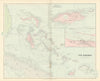

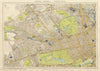

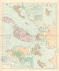

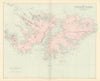

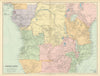

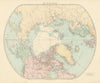


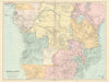

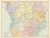


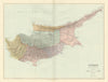


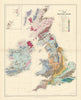

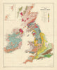


Stanford’s London Atlas of Universal Geography was a landmark British world atlas of the late 19th and early 20th centuries, evolving through several significant editions. The atlas originated with preliminary elephant folio editions in 1884 and 1885, each comprising 70 maps and marked “Printed for Private Circulation.” The first public edition appeared in 1887, featuring 90 maps that combined updated plates from John Arrowsmith—whose atlas plates Stanford had acquired in 1874—with new material reflecting contemporary geographic knowledge. A second edition followed in 1893, expanded to 100 maps, with subsequent issues in 1896, 1898, and 1901, each incorporating revisions and updates. The third and final major edition was published in 1904, containing 110 maps and showcasing advancements in cartographic detail and colour lithography. Throughout its iterations, the atlas was esteemed for its precision, clarity, and comprehensive coverage, serving as a vital reference for scholars, educators, and professionals during a period of significant global exploration and geopolitical change.
EU orders up to €150 are sent VAT- and duty-paid — no additional taxes on arrival
Authenticity Guaranteed - We only sell original antique & vintage items
Can we help? Call us on +44-208-960-3476 • FAQs
All our products are exempt from US tariffs — no additional duties or taxes payable on arrival.
- Shop by Country
- Shop by Cartographer
- Shop Maps by Type
- Shop Prints by Subject