
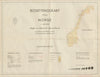

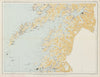

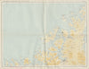


Where people lived across Norway, from Oslo to Kirkenes, is the subject of these maps by Statistisk sentralbyrå, the national statistical bureau, established as an independent body in 1876. The sheets come from Bosettingskart over Norge, published in 1950 and printed in Oslo by Norsk Lithografisk Officin, with an index and regional maps running from the south to Finnmark. Oslo and Hamar, Bergen and Haugesund, Trondheim and Steinkjer, and Bodø and Narvik mark the way north, and the far north reaches Tromsø, Hammerfest, Alta, Vardø and inland Karasjok and Kautokeino. These are settlement maps rather than city plans.
EU orders up to €150 are sent VAT- and duty-paid — no additional taxes on arrival
Authenticity Guaranteed - We only sell original antique & vintage items
Can we help? Call us on +44-208-960-3476 • FAQs
All our products are exempt from US tariffs — no additional duties or taxes payable on arrival.


- Shop by Country
- Shop by Cartographer
- Shop Maps by Type
- Shop Prints by Subject