


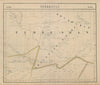

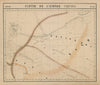


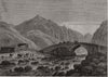


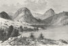


Expedition routes over the Alai and the Pamir, glacier surveys and sketch maps of the khanates make this a record of exploration in the high mountains of Central Asia, in what is now Tajikistan. Royal Geographical Society material follows Fedchenko's work around Maghian and later Alai-Pamir expeditions, and includes a map of the Schurovsky Glacier and sections through the Tian Shan, Pamir and Hindu Kush. Vandermaelen's 1827 atlas places the district within Turkestan, and sketch maps examine Khujand, the Syr Darya and the Amu Darya. The prints show Khujand, local people, Lake Iskanderkul, a bridge over the Surkhab and the shrine at Gorif, decorated with ibex horns.
EU orders up to €150 are sent VAT- and duty-paid — no additional taxes on arrival
Authenticity Guaranteed - We only sell original antique & vintage items
Can we help? Call us on +44-208-960-3476 • FAQs
All our products are exempt from US tariffs — no additional duties or taxes payable on arrival.


- Shop by Country
- Shop by Cartographer
- Shop Maps by Type
- Shop Prints by Subject