




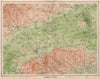


Locks, riverside towns and boating routes fill these maps of the Thames Valley, following the river from its upper reaches down towards London. Rocque's local sheets and later regional maps link Oxford, Abingdon, Henley, Marlow and Windsor with the surrounding counties, navigation plans cover the stretch between Boulters Lock and Mortlake, and panoramic and folding river maps follow the Thames as one continuous route. Touring and cycling sheets range inland into the Chilterns, the Berkshire Downs and the neighbouring countryside, and geological, drainage and relief maps show the shape of the valley and its tributaries. The prints include prospects from Windsor Castle and riverside landscapes around Hurley.
EU orders up to €150 are sent VAT- and duty-paid — no additional taxes on arrival
Authenticity Guaranteed - We only sell original antique & vintage items
Can we help? Call us on +44-208-960-3476 • FAQs
All our products are exempt from US tariffs — no additional duties or taxes payable on arrival.


- Shop by Country
- Shop by Cartographer
- Shop Maps by Type
- Shop Prints by Subject