


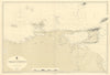


The Orinoco, the Caribbean coast and the mountains around Mérida feature in these maps of Venezuela, dating from the seventeenth to the mid-twentieth century. Regional sheets set the country beside New Granada, Ecuador and the Guianas, while closer maps cover Caracas and La Guaira, Puerto Cabello and the Paraguaná Peninsula. River diagrams show the Maipures and Atures rapids, coastal charts reach Trinidad, Tobago and Margarita, and twentieth-century maps add geology and oil. The prints show inhabitants, landscapes and flags, including national and presidential flags.
EU orders up to €150 are sent VAT- and duty-paid — no additional taxes on arrival
Authenticity Guaranteed - We only sell original antique & vintage items
Can we help? Call us on +44-208-960-3476 • FAQs
All our products are exempt from US tariffs — no additional duties or taxes payable on arrival.


- Shop by Country
- Shop by Cartographer
- Shop Maps by Type
- Shop Prints by Subject