
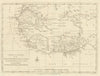


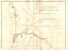


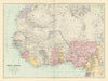


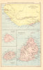
The Gold Coast, Ashanti and the caravan routes of the Niger basin appear in these maps of West Africa, which cover the region from the western Sahara to the Gulf of Guinea. Nineteenth- and twentieth-century maps record names such as French Sudan beside Nigeria, Gambia and their neighbours, while sheets on the Fulahs in Senegambia and on caravan routes around Sokoto and Masina map peoples and trade. Later military maps follow the Takoradi air reinforcement route across Africa towards Sudan and Egypt. Prints add the region's people and landscapes, across material from the sixteenth to the twentieth century.
EU orders up to €150 are sent VAT- and duty-paid — no additional taxes on arrival
Authenticity Guaranteed - We only sell original antique & vintage items
Can we help? Call us on +44-208-960-3476 • FAQs
All our products are exempt from US tariffs — no additional duties or taxes payable on arrival.


- Shop by Country
- Shop by Cartographer
- Shop Maps by Type
- Shop Prints by Subject