


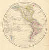


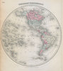



Island California, the Republic of Texas and BOAC air routes all appear in these maps of the Western Hemisphere, which follow changing ideas of the Americas from the seventeenth century to the twentieth. Mallet's maps preserve the old Californian misconception, while later decorative sheets associated with Cruchley, Dower and Colton set the Americas in hemisphere-wide compositions. A Gall and Inglis map still labels the Republic of Texas and New Mexico Territory. There is also a map associated with Vaugondy's geographical work, political and drainage-basin maps, Ruth Taylor White's pictorial treatment, and BOAC route mapping from the age of post-war aviation.
EU orders up to €150 are sent VAT- and duty-paid — no additional taxes on arrival
Authenticity Guaranteed - We only sell original antique & vintage items
Can we help? Call us on +44-208-960-3476 • FAQs
All our products are exempt from US tariffs — no additional duties or taxes payable on arrival.


- Shop by Country
- Shop by Cartographer
- Shop Maps by Type
- Shop Prints by Subject