Hide out of stock items

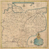


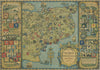


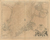

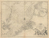


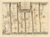


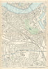


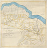


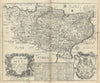


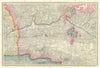


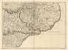

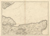


Browse our stock of antique maps and old prints of Kent, its people, coast, seaside resorts, towns and villages including Dover, Ashford, Folkestone, Gravesend & Rochester. We have sea charts by Collins (1774), Tombleson's decorative "Picturesque views on the Thames and Medway" (1835), copperplate prints from Gostling's "Walk in and about the city of Canterbury" (1825), town views from "Virtue's Picturesque Beauties of Great Britain" (Shepherd, Bartlett, Gastineau &c 1829), plates from Grose's "Antiquities" (1776). We have street maps of London suburbs from Geographia's "Authentic Map Directory" (1920's-1930's). For Greenwich, see London