


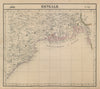


Rivers, delta channels and steamer routes run through these maps of Bangladesh, whatever name the region bore at the time. Older sheets by Bellin, Jefferys, Vandermaelen and the SDUK describe Bengal and the mouths of the Ganges, often with Calcutta, while later maps use East Pakistan or Bangladesh. Survey of India sheets give closer coverage of the Sundarbans, Barisal, Sylhet and the north-eastern borderlands, and railway and steamer mapping is particularly revealing in a country where so much travel is by water. The prints add views of Dhaka and Sylhet, flood scenes and other local subjects.
EU orders up to €150 are sent VAT- and duty-paid — no additional taxes on arrival
Authenticity Guaranteed - We only sell original antique & vintage items
Can we help? Call us on +44-208-960-3476 • FAQs
All our products are exempt from US tariffs — no additional duties or taxes payable on arrival.


- Shop by Country
- Shop by Cartographer
- Shop Maps by Type
- Shop Prints by Subject