


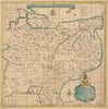


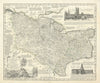


From English counties to the West Indies, and even the world before the Flood, these maps by Emanuel Bowen (about 1693–1767), whose name is also catalogued as Emmanuel, show one of the busiest engravers of eighteenth-century Britain at work for atlases and periodicals. The county maps include Kent, Middlesex, Buckinghamshire, Derbyshire, Northamptonshire and Staffordshire, with Ireland and Scotland, Antigua, the West Indies and the Netherlands beyond. Canterbury diocesan mapping is among the earliest material.
EU orders up to €150 are sent VAT- and duty-paid — no additional taxes on arrival
Authenticity Guaranteed - We only sell original antique & vintage items
Can we help? Call us on +44-208-960-3476 • FAQs
All our products are exempt from US tariffs — no additional duties or taxes payable on arrival.


- Shop by Country
- Shop by Cartographer
- Shop Maps by Type
- Shop Prints by Subject