


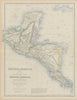

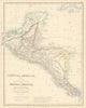

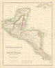


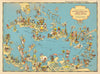


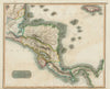


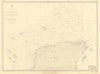


Rival schemes to cut through Panama or Nicaragua give these maps of Central America a compelling theme: the competing ways to link the Atlantic and the Pacific. Nineteenth-century sheets by Swanston, Johnson, Stanford and the Society for the Diffusion of Useful Knowledge record Guatemala, Honduras, Nicaragua and their neighbours, often with southern Mexico and the West Indies, while maps of railway and canal routes trace the proposed crossings. Coastal charts cover the Yucatán shore and offshore banks, and twentieth-century strategic maps set the region within wartime hemispheric communications. Prints and decorative map vignettes add towns and landscapes.
EU orders up to €150 are sent VAT- and duty-paid — no additional taxes on arrival
Authenticity Guaranteed - We only sell original antique & vintage items
Can we help? Call us on +44-208-960-3476 • FAQs
All our products are exempt from US tariffs — no additional duties or taxes payable on arrival.


- Shop by Country
- Shop by Cartographer
- Shop Maps by Type
- Shop Prints by Subject