
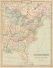


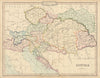


Upper and Lower Canada, the Republic of Texas and the Austrian and Ottoman empires survive on these antique maps by George Frederick Cruchley, the Fleet Street mapmaker, engraver and publisher whose work served the Victorian schoolroom. He lived from 1797 to 1880, and most of the maps here come from his general atlas of 1843, which supplied geography for education and private study, from the hemispheres to individual European countries, the Americas, Africa and Asia. Maps of Canaan and Palestine show a parallel interest in sacred geography, and later county railway maps represent the practical side of his output.
EU orders up to €150 are sent VAT- and duty-paid — no additional taxes on arrival
Authenticity Guaranteed - We only sell original antique & vintage items
Can we help? Call us on +44-208-960-3476 • FAQs
All our products are exempt from US tariffs — no additional duties or taxes payable on arrival.


- Shop by Country
- Shop by Cartographer
- Shop Maps by Type
- Shop Prints by Subject