
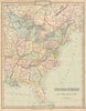


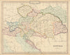


Venetian Lombardy, the Sardinian states and the Republic of Texas still appear in maps from Cruchley's General Atlas, published in London in 1843 for schools and private tuition. George Frederick Cruchley issued it from his Fleet Street premises as a compact educational sequence, beginning with the hemispheres and moving through continents and countries whose names preserve the political world of the early Victorian period. North American sheets record Upper and Lower Canada, maps of Africa, China, the East Indies and the Caribbean carry the atlas well beyond Europe, and sacred geography has its place in maps of Canaan and Palestine.
EU orders up to €150 are sent VAT- and duty-paid — no additional taxes on arrival
Authenticity Guaranteed - We only sell original antique & vintage items
Can we help? Call us on +44-208-960-3476 • FAQs
All our products are exempt from US tariffs — no additional duties or taxes payable on arrival.


- Shop by Country
- Shop by Cartographer
- Shop Maps by Type
- Shop Prints by Subject