


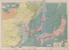

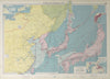


Corea, Formosa and Yedo, the old names of the region, recur throughout these maps of East Asia, which follow China, Japan and Korea from early atlas maps to the Korean conflict. Bellin's eastern Tartary and maps of China and its neighbours by Bonne and Homann precede nineteenth-century sheets by Tallis, Johnston, Bartholomew and others, with Chosen among the later names. Port charts and shipping maps link the mainland and islands with the western Pacific, and railway maps give particular attention to Korea and Manchuria. Twentieth-century strategic maps cover Japanese expansion, the Pacific war and the Korean conflict, and prints show the people and dress of eastern Tartary.
EU orders up to €150 are sent VAT- and duty-paid — no additional taxes on arrival
Authenticity Guaranteed - We only sell original antique & vintage items
Can we help? Call us on +44-208-960-3476 • FAQs
All our products are exempt from US tariffs — no additional duties or taxes payable on arrival.


- Shop by Country
- Shop by Cartographer
- Shop Maps by Type
- Shop Prints by Subject