
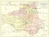


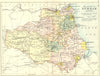

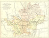

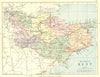
English counties, the Channel Islands and a railway map of England and Wales make up this late Victorian group from the geographical publisher George Philip & Son. Issued in 1887 and 1898, the maps range from Cheshire and Durham to Dorset, Kent and Hertfordshire, with Buckinghamshire and Oxfordshire sharing a sheet, and the Isle of Man, the Isle of Wight and the Channel Islands have maps of their own. The sheets do not all come from one edition, and Durham and Hertfordshire appear in later impressions too.
EU orders up to €150 are sent VAT- and duty-paid — no additional taxes on arrival
Authenticity Guaranteed - We only sell original antique & vintage items
Can we help? Call us on +44-208-960-3476 • FAQs
All our products are exempt from US tariffs — no additional duties or taxes payable on arrival.


- Shop by Country
- Shop by Cartographer
- Shop Maps by Type
- Shop Prints by Subject