


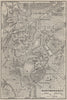


Montmorency stands between Enghien-les-Bains and its forest on the heights north of Paris, and its maps record the meeting of wooded hills and old settlements with the growing suburbs of the capital. The earliest, of 1860, places the town among Enghien, Eaubonne, Saint-Gratien, Groslay and Soisy. Touring maps of 1898 to 1910 cover the country from Saint-Denis to Pontoise, including the Forêt de Montmorency. Town plans of 1907 and 1910 join Montmorency with Enghien, Deuil and Soisy, and the vintage plans of the 1920s pair it with Argenteuil or show the town alone.
EU orders up to €150 are sent VAT- and duty-paid — no additional taxes on arrival
Authenticity Guaranteed - We only sell original antique & vintage items
Can we help? Call us on +44-208-960-3476 • FAQs
All our products are exempt from US tariffs — no additional duties or taxes payable on arrival.


- Shop by Country
- Shop by Cartographer
- Shop Maps by Type
- Shop Prints by Subject