


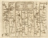


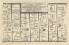
Wells-next-the-Sea is a north Norfolk port whose quay sits behind the marshes that separate it from the open sea, and its early road maps show how travellers made their way across the county to reach it. The oldest is Ogilby's strip map of 1675, plate 52, following the road from Newmarket through Swaffham to Wells, with Bury St Edmunds on the same sheet. Senex mapped the same road in 1719, and Owen and Bowen's map of 1753 brings the town in by way of Fakenham and Walsingham.
EU orders up to €150 are sent VAT- and duty-paid — no additional taxes on arrival
Authenticity Guaranteed - We only sell original antique & vintage items
Can we help? Call us on +44-208-960-3476 • FAQs
All our products are exempt from US tariffs — no additional duties or taxes payable on arrival.


- Shop by Country
- Shop by Cartographer
- Shop Maps by Type
- Shop Prints by Subject